
Illustration

This U.S. National Park Services map shows the major ancestral Puebloan sites in the Four Corners area of what is now the United States of America.
About the Author

James is a writer and former Professor of History. He holds an MA in World History with a particular interest in cross-cultural exchange and world history. He is a co-founder of World History Encyclopedia and formerly was its Communications Director.
Related Images
Image
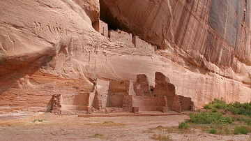
White House Ruins, Canyon de Chelly
The White House Ruins, Canyon de Chelly, Arizona, USA. White House...
Image
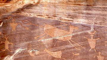
Hunting Petroglyphs, Canyon de Chelly
Hunting Petroglyphs from Canyon de Chelly, a protected site with...
Image
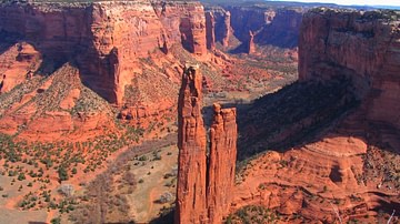
Spider Rock, Canyon de Chelly
Spider Rock, Canyon de Chelly, Arizona, USA. The canyon boasts...
Image
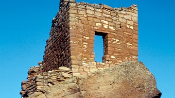
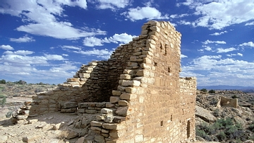
Stronghold House, Hovenweep
A tower or stronghold house, Hovenweep National Monument, Colorado-Utah...
Image
Cajon Tower, Hovenweep
A tower of the Cajon group, Hovenweep National Monument, Colorado-Utah...

Image
Tower Ruins, Hovenweep
Ruined towers, the 'Cutthroat' group, Hovenweep National Monument...
Cite This Work
APA Style
Wiener, J. B. (2019, January 11). Map of Ancestral Puebloan Sites in US Southwest. World History Encyclopedia. Retrieved from https://www.worldhistory.org/image/9850/map-of-ancestral-puebloan-sites-in-us-southwest/
Chicago Style
Wiener, James Blake. "Map of Ancestral Puebloan Sites in US Southwest." World History Encyclopedia. Last modified January 11, 2019. https://www.worldhistory.org/image/9850/map-of-ancestral-puebloan-sites-in-us-southwest/.
MLA Style
Wiener, James Blake. "Map of Ancestral Puebloan Sites in US Southwest." World History Encyclopedia. World History Encyclopedia, 11 Jan 2019. Web. 18 Apr 2024.