
Illustration

A map illustrating the extent of the Wari (Huari) civilization (purple) which flourished in Peru between c. 450 and 1000 CE. The extent of the contemporary Tiwanaku culture is indicated in light blue.
License & Copyright
 Based on Wikipedia content that has been reviewed, edited, and republished.
Original image by JohnnyMr Ninja. Uploaded by Mark Cartwright, published on 24 June 2015. The copyright holder has published this content under the following license: Public Domain. This item is in the public domain, and can be used, copied, and modified without any restrictions. Please note that content linked from this page may have different licensing terms.
Based on Wikipedia content that has been reviewed, edited, and republished.
Original image by JohnnyMr Ninja. Uploaded by Mark Cartwright, published on 24 June 2015. The copyright holder has published this content under the following license: Public Domain. This item is in the public domain, and can be used, copied, and modified without any restrictions. Please note that content linked from this page may have different licensing terms.
Related Images
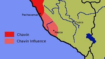
Chavin Civilization Map
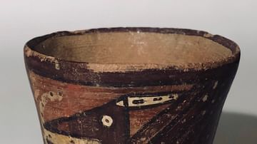
Wari Kero (Drinking Cup) from Peru
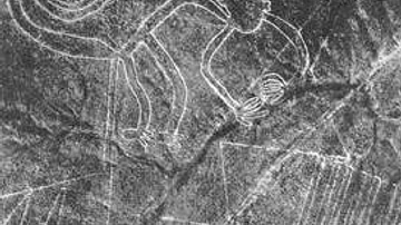
Nazca Line Monkey
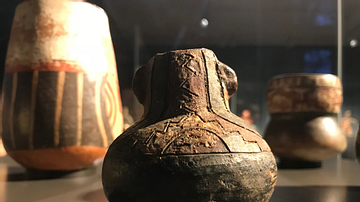
Paracas Ceremonial Vessel
Nazca Line Hummingbird
Nazca Line Spider
Cite This Work
APA Style
Ninja, J. (2015, June 24). The Wari Empire. World History Encyclopedia. Retrieved from https://www.worldhistory.org/image/3958/the-wari-empire/
Chicago Style
Ninja, JohnnyMr. "The Wari Empire." World History Encyclopedia. Last modified June 24, 2015. https://www.worldhistory.org/image/3958/the-wari-empire/.
MLA Style
Ninja, JohnnyMr. "The Wari Empire." World History Encyclopedia. World History Encyclopedia, 24 Jun 2015. Web. 19 Apr 2024.