
Illustration

A map of Palestine circa 830 BC, showing the kingdoms of Israel and Judah, as well as the surrounding kingdoms and tribes.
Related Images
Image
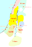
Map of Ancient Israel
A map of the ancient Kingdom of Israel and its neighbours.
Image
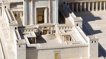
Model of Herod's Renovation of the Temple of Jerusalem
A model of the lavish renovation of the Temple of Jerusalem carried...
Image
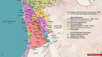
Herodian Tetrarchy in the Levant, c. 5 CE
A map illustrating the geopolitical situation in the Levant after...
Image
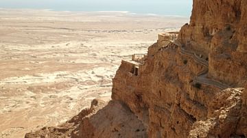
Northern Palace of Masada
Constructed during the Herodian period (late 1st century BCE...
Image
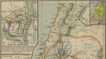
Ancient Palestine
Insets: Plan of Jerusalem. Dominions of David and Solomon (1025-953...
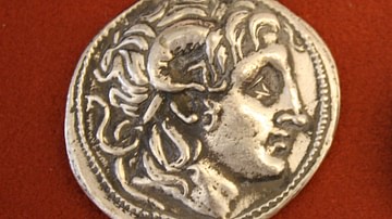
Image
Alexander as Ammon-Zeus
Silver tetradrachm from Thrace, reign of Lysimachus, 323-281 BCE...
Cite This Work
APA Style
Richardprins, . (2012, April 26). Map of the Levant circa 830 BCE. World History Encyclopedia. Retrieved from https://www.worldhistory.org/image/285/map-of-the-levant-circa-830-bce/
Chicago Style
Richardprins, . "Map of the Levant circa 830 BCE." World History Encyclopedia. Last modified April 26, 2012. https://www.worldhistory.org/image/285/map-of-the-levant-circa-830-bce/.
MLA Style
Richardprins, . "Map of the Levant circa 830 BCE." World History Encyclopedia. World History Encyclopedia, 26 Apr 2012. Web. 24 Apr 2024.