
Illustration

Map showing the spread of Christianity, showing both strongly Christianized areas before 325 CE and generally Christianized areas until 600 CE. The map also shows major Christian centers and the cities in which Christian councils were held.
Related Images

Council of Chalcedon

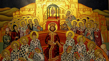
Fresco Depicting the Council of Chalcedon
First Council of Nicaea
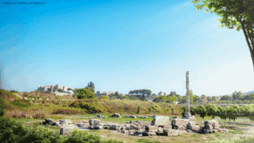
Temple of Artemis at Ephesus, Reconstructed
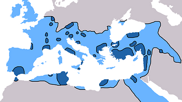
Spread of Christianity 325-600 AD
References
- Kinder, H., Hilgemann, W. dtv-Atlas Weltgeschichte. Deutscher Taschenbuch Verlag, 1999, 106.
Cite This Work
APA Style
Mykytiuk, K. (2020, January 16). Spread of Christianity Map (up to 600 CE). World History Encyclopedia. Retrieved from https://www.worldhistory.org/image/11713/spread-of-christianity-map-up-to-600-ce/
Chicago Style
Mykytiuk, Karyna. "Spread of Christianity Map (up to 600 CE)." World History Encyclopedia. Last modified January 16, 2020. https://www.worldhistory.org/image/11713/spread-of-christianity-map-up-to-600-ce/.
MLA Style
Mykytiuk, Karyna. "Spread of Christianity Map (up to 600 CE)." World History Encyclopedia. World History Encyclopedia, 16 Jan 2020. Web. 18 Apr 2024.