
Illustration

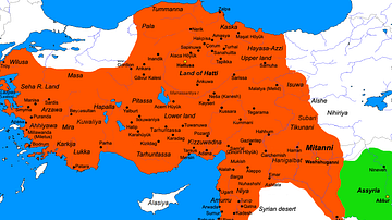
A map showing the Hittite Empire in c. 1350-1300 BCE (dark green line) and at its maximum extent (light green area).
License & Copyright
 Based on Wikipedia content that has been reviewed, edited, and republished.
Original image by Ikonact. Uploaded by Jan van der Crabben, published on 11 August 2014. The copyright holder has published this content under the following license: Creative Commons Attribution-ShareAlike. This license lets others remix, tweak, and build upon a work even for commercial reasons, as long as they credit the author and license their new creations under the identical terms. When republishing on the web a hyperlink back to the original content source URL must be included. Please note that content linked from this page may have different licensing terms.
Based on Wikipedia content that has been reviewed, edited, and republished.
Original image by Ikonact. Uploaded by Jan van der Crabben, published on 11 August 2014. The copyright holder has published this content under the following license: Creative Commons Attribution-ShareAlike. This license lets others remix, tweak, and build upon a work even for commercial reasons, as long as they credit the author and license their new creations under the identical terms. When republishing on the web a hyperlink back to the original content source URL must be included. Please note that content linked from this page may have different licensing terms.
Related Images
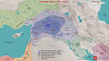
The Mitanni Empire, c. 1500-1300 BCE
Map of the Hittite Empire (c. 1300 BC)
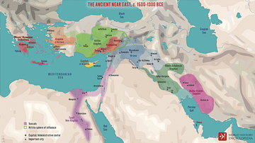
The Ancient Near East c. 1500-1300 BCE
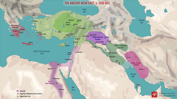
The Ancient Near East, c. 1300 BCE
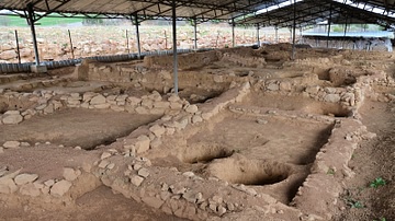
Hittite Workshops in Sapinuwa
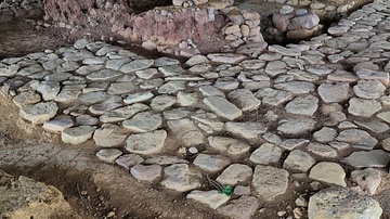
Hittite Street in Sapinuwa
Cite This Work
APA Style
Ikonact, . (2014, August 11). Map of the Hittite Empire. World History Encyclopedia. Retrieved from https://www.worldhistory.org/image/2915/map-of-the-hittite-empire/
Chicago Style
Ikonact, . "Map of the Hittite Empire." World History Encyclopedia. Last modified August 11, 2014. https://www.worldhistory.org/image/2915/map-of-the-hittite-empire/.
MLA Style
Ikonact, . "Map of the Hittite Empire." World History Encyclopedia. World History Encyclopedia, 11 Aug 2014. Web. 16 Apr 2024.